


Precinct 37 - Zephyr Cove, Douglas County, Nevada
About
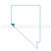
Outline

Summary
| Unique Area Identifier | 615265 |
| Name | Precinct 37 - Zephyr Cove |
| County | Douglas County |
| State | Nevada |
| Area (square miles) | 2.13 |
| Land Area (square miles) | 2.12 |
| Water Area (square miles) | 0.00 |
| % of Land Area | 99.79 |
| % of Water Area | 0.21 |
| Latitude of the Internal Point | 39.01333200 |
| Longtitude of the Internal Point | -119.92348550 |
Maps


Graphs
Select a template below for downloading or customizing gragh for Precinct 37 - Zephyr Cove, Douglas County, Nevada


Neighbors
Neighoring Voting District (by Name) Neighboring Voting District on the Map
- Precinct 36 - Skyland, Douglas County, NV
- Precinct 38 - Round Hill, Douglas County, NV
- Precinct 5 - Genoa, Douglas County, NV
- Voting Districts not defined, Douglas County, NV
Top 10 Neighboring County Subdivision (by Population) Neighboring County Subdivision on the Map
Top 10 Neighboring Place (by Population) Neighboring Place on the Map
- Kingsbury CDP, NV (2,152)
- Round Hill Village CDP, NV (759)
- Zephyr Cove CDP, NV (565)
- Skyland CDP, NV (376)
Top 10 Neighboring Unified School District (by Population) Neighboring Unified School District on the Map
Top 10 Neighboring State Legislative District Lower Chamber (by Population) Neighboring State Legislative District Lower Chamber on the Map
Top 10 Neighboring State Legislative District Upper Chamber (by Population) Neighboring State Legislative District Upper Chamber on the Map
Top 10 Neighboring 111th Congressional District (by Population) Neighboring 111th Congressional District on the Map
Top 10 Neighboring Census Tract (by Population) Neighboring Census Tract on the Map
- Census Tract 17, Douglas County, NV (1,601)
- Census Tract 16, Douglas County, NV (1,591)
- Census Tract 19, Douglas County, NV (1,343)